Oh Kalbarri, why did we neglect you for so long??
Kalbarri is a national park that has been a bit hidden from our view. On our first trip to WA, we drove straight past it. It tends to live in the shadow of its better known big brother, Karijini, the spectacular park in the Pilbara that is often regarded as Australia’s best NP. I must admit to getting them mixed up early in our travels and really only considering the Pilbara NP as the one to visit. West Australians of course have always known of the beauty of Kalbarri and it has been a popular destination for them for many years, specially as its just 600km from Perth so within a days drive to get here.
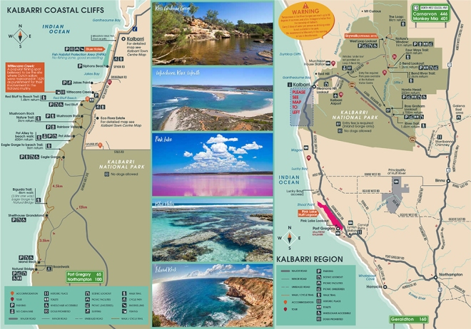
Kalbarri is unique in that it offers two completely different experiences for the visitor. The inland gorges offer spectacular scenery, carved out by the Murchison River into a grand canyon like vista. In complete contrast, the coastal section of the park offers something like a cross between Victoria’s spectacular Great Ocean Rd and South Australia’s Bunda cliffs. Place all of this near a gorgeous coastal village with a climate that allows almost year round accessiblilty and you have the makings of a brilliant NP.
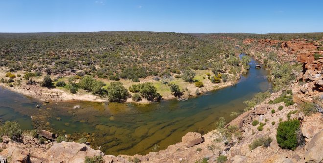
Driving into Kalbarri from the south gives you little indication of the beauty of the coastline. The scene is one of flat coastal scrub leading to the ocean which you occasionally glimpse to your left. Its not until you enter the town proper and see the vista of the Murchison River inlet and river mouth below you that you get an inkling that this might be a special place. It’s all laid out before you, looking just like a perfect landscape painting. We arrived on a perfect day too, so we had that perfect Australian clear blue sky, contrasting with white sandy beaches and pale blue river. We needed to stay in a CP to catch up on our domestic duties which was just as well, because this section of the coast has virtually no free camps and a couple of not very cheap station stays. There is no accommodation or camping at all in the NP. After a quick drive round, we decided on the Kalbarri Tudor Holiday Park, which turned out to be nice, well run park with shady sites and clean amenities. We spent the afternoon doing our washing and getting the van tidied up.
Deb had pre booked a dog minding service for Molly for the next two days so we could spend our time enjoying the NP. By coincidence it turned out that our good friends Kevin and Marie from Mandurah knew the pet minder very well so when we found that out, we were very confident Molly would be well looked after. We dropped her off early and headed out for a day exploring the inland gorges. Surprisingly, it was really cold, despite the full, bright sun. A bitter wind was blowing in from the east.
This section of the park requires payment of an entrance fee, $13 for vehicle day pass, which is very reasonable considering the excellent sealed roads throughout the park and very well established picnic facilities, lookouts and toilets at the key gorges. The Western Loop lookout is currently closed while they construct a “Skyway” platform extending out over the gorge, but all other attractions were open.
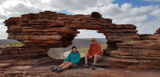
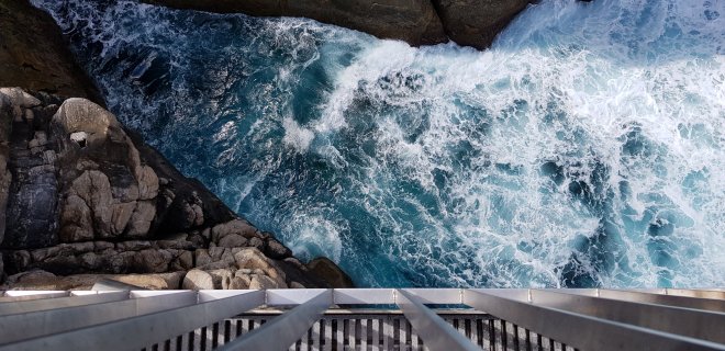
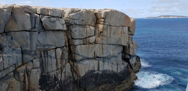
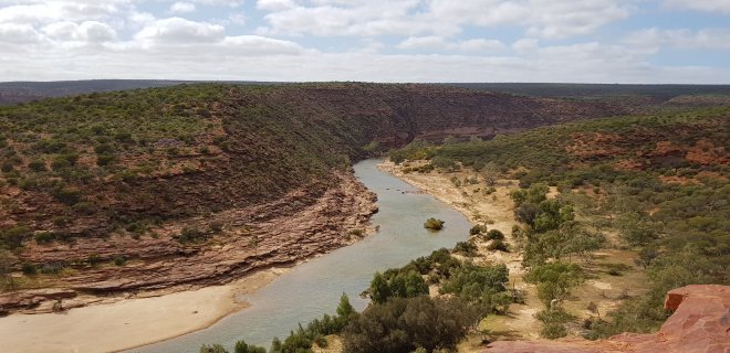
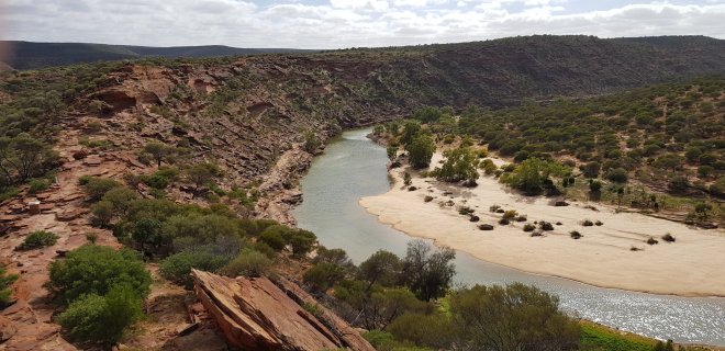
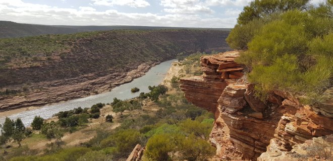
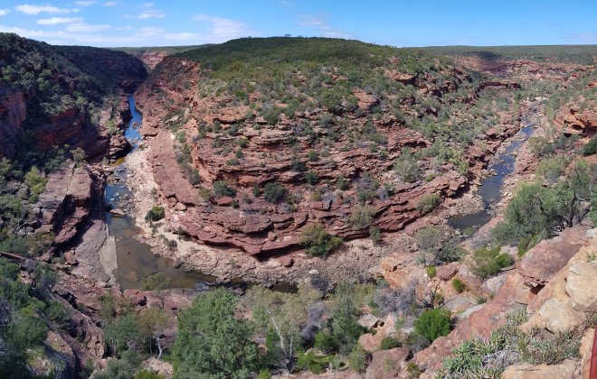
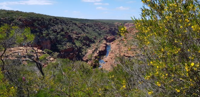
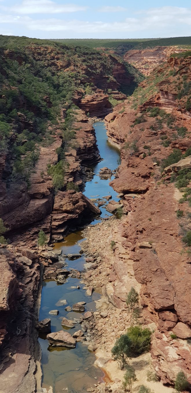
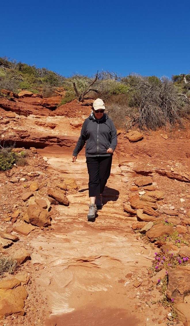
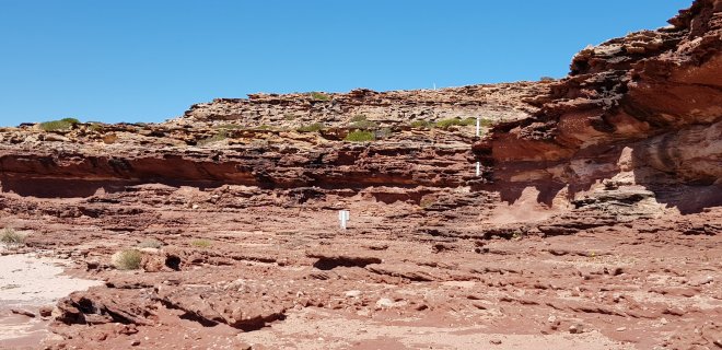
The drive out to the gorges is very flat and except for the masses of wildflowers, is fairly uninteresting, just flat scrubby vegetation as far as the eye can see. Our first stop was Natures Window and when we arrived at the car park we got an inkling of just how magnificent this park was going to be. The car park is perched on the edge of the very deep gorge carved out by the Murchison River through multiple layers of striking, stripey Tumblagooda Sandstone. This place is a geologists dream! The river trickles through the gorge 150 metres below. Over the millenia, it has carved out a spectacular gorge, eroding away the sandstone and leaving incredible rock formations behind. We were blown away by the scene, surely one of the most magnificent river gorges in the country. Natures window is a natural formation just a short walk away from the carpark, and consists of a hole right through the rocks, framing the river and gorge below. It is one of WA’s most iconic photo locations and we joined the small number of other early risers to take turns to get our own iconic photo. The view is breathtaking! We spent some time just admiring it and I went for a short walk down towards the river to get a different perspective. There is a full 8 km circuit walk that runs along the top of the gorge, before dropping steeply down to the river, then following the river for a few km before climbing steeply back up again. We didn’t really feel up to such a strenuous walk so contented ourselves with enjoying the view from the top. Our peace was shattered for a while by a couple of Irish families who had dragged their unenthusiastic small children down to look at the window. Long after they left we could hear the mother’s voice echoing up and down the gorge, but eventually peace reigned again!
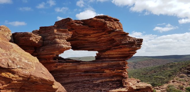
Natures Window
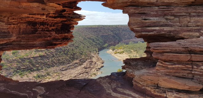
View through the Window to the Murchison River

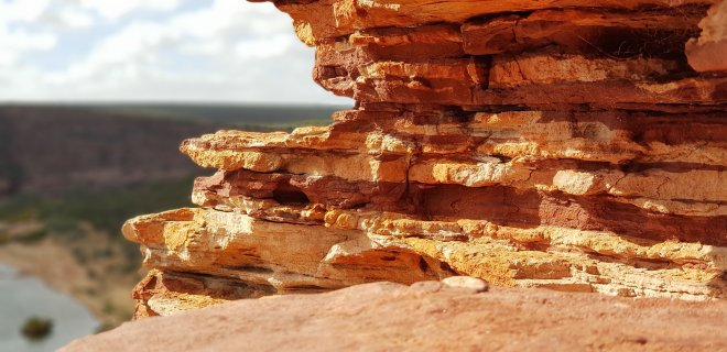
Layers of beautiful Tumblagooda Sandstone
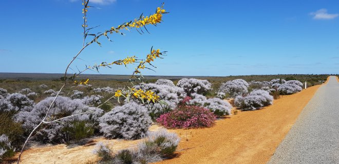
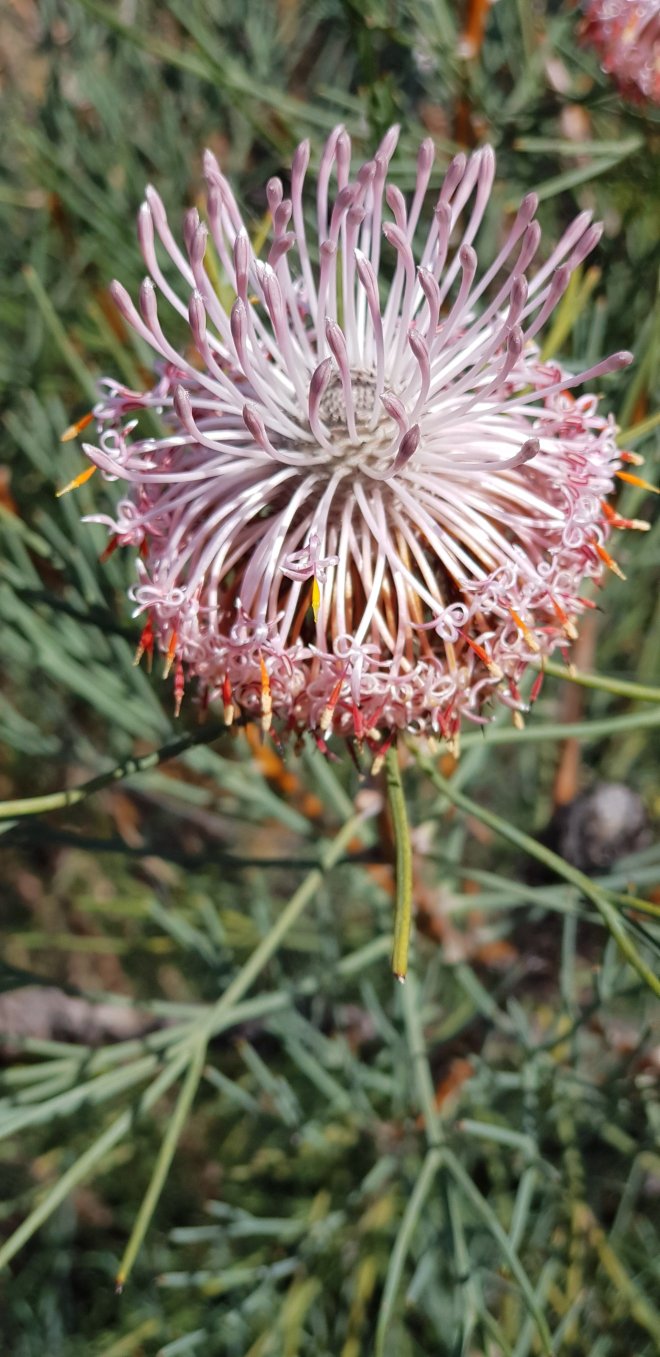
Of course, the wildflowers were spectacular in the park. Different from the ones we had seen around Mulwela, but so many amazing shapes and colours along the roadside and walking tracks.
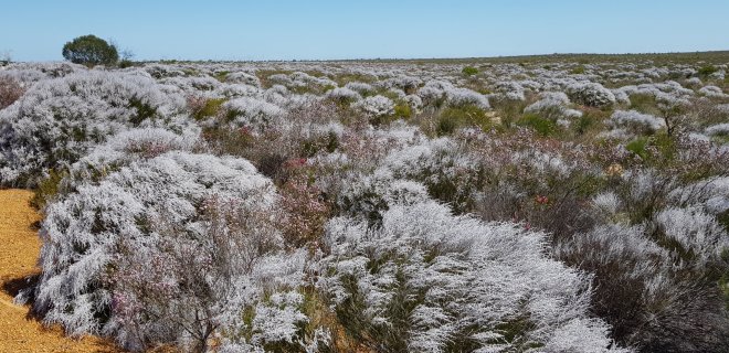
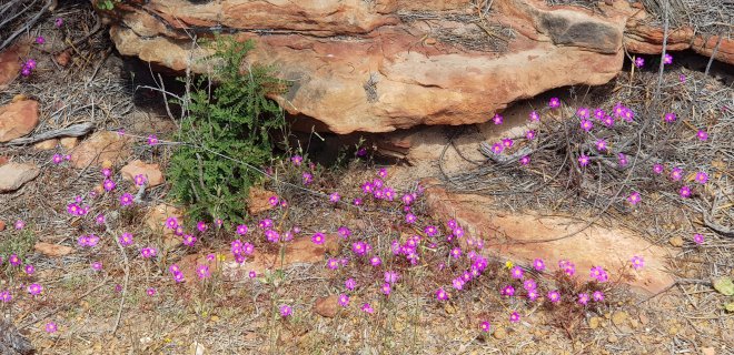
Our next stop was Z Bend Lookout a few km further up the river. Here, we looked down a deep gorge that switched back sharply in a Z shape. Incredibly sharp turns in such a deep gorge producing some spectacular views down into the gorge. This is another favourite photo opportunity, and luckily as we were here early, it wasn’t too busy. There were plenty of wildflowers to see too, alongside the roads and paths to the lookouts. We stopped here for our picnic lunch.
Z Bend
We then drove around 50km to the next two lookouts, Ross Graham and Hawks Head. These two lookouts are further out from Kalbarri, so less popular, but still very impressive. Hawks Head is a rock formation that supposedly looks like a Hawks head, but you needed a very good imagination so really see it. At Ross Graham lookout we took a walk trail down into the gorge to the river. Its not as deep here so the walk was steep but short. Down by the river we enjoyed a short break and took in the views typical of Murchison River country: deep red sandstone rocks, the river and beautiful white gum trees spreading out over the river bed. Gorgeous! There were three National Park workers rebuilding parts of the trail, backbreaking work moving new rock steps into place. All the work was done by hand, and all their tools had to be carried down into the gorge. It made us appreciate the efforts made to make our visit comfortable, safe and easy. After a full day exploring, we returned to collect Molly who had obviously had a great time with Simone and the other dogs.
Murchison River upstream near Ross Graham Lookout
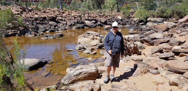
Down by the Murchison River
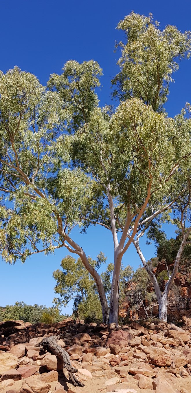
Gorgeous gums by the Murchison River
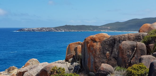
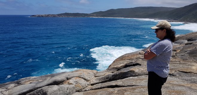
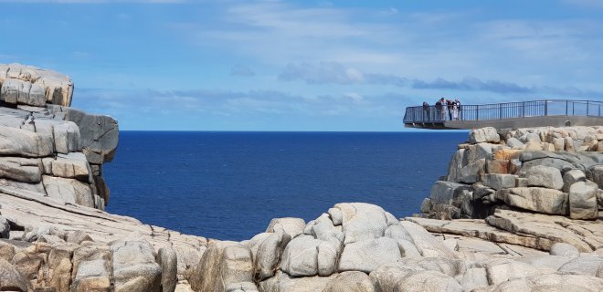
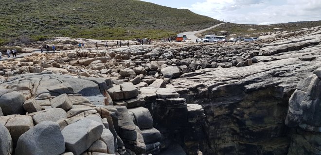
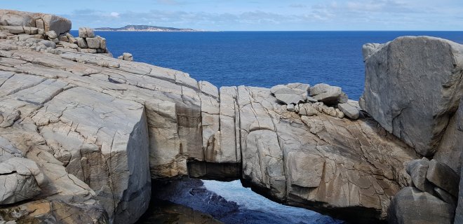
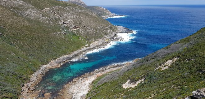
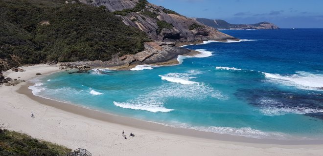
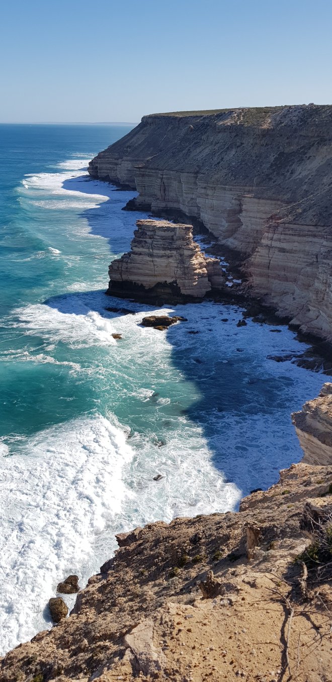
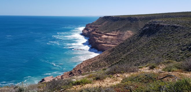
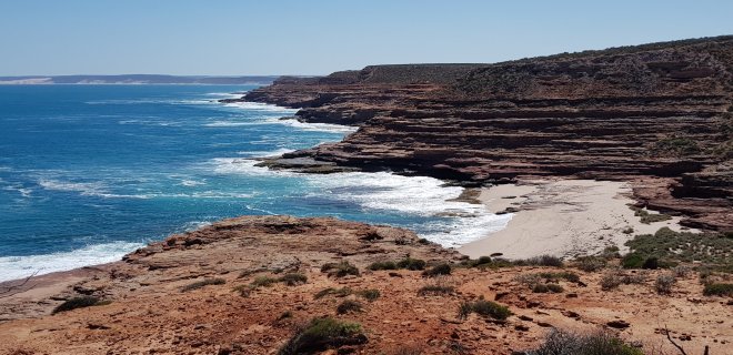
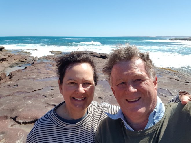
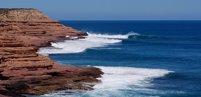
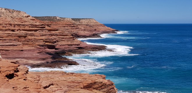
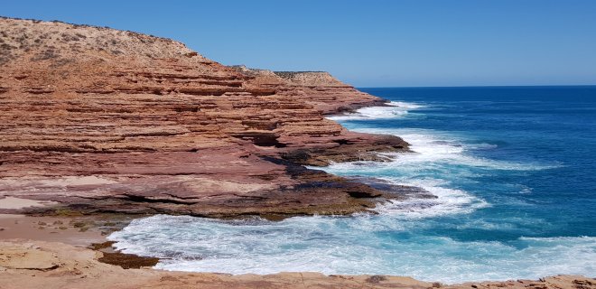
The next day was for exploring the sea cliffs section of the park, just south of the Kalbarri township. Molly was much happier to stay with Simone today, despite there being some much bigger dogs to contend with today! I don’t think it took her long to sort them all out. We headed out the 15km to the most southern lookout, Natural Bridge. Again, it was very sunny, but with a strong, cold wind from the east so we needed to rug up again. We gradually made our way north back towards town, driving in from the highway to every lookout. The scenery was spectacular! Island Rock, Natural Bridge and the Grandstand were the first lookouts and revealed incredible steep cliffs with multiple layers of coloured rock dropping down into a perfectly blue sea. Again, there were lots of wild flowers to see, many different ones from yesterdays inland gorges. At Eagle Gorge we hiked down to the beach, a steep climb down into a pretty valley with fantastic views of the beautiful beach below. We enjoyed a break on the rocks, lapping up the sunshine as we were out of the cold wind down on the beach. Out next stop was Pot Alley, so called because lobster fishermen always lose lots of cray pots here in the rough bay. After waiting ages for a mini bus load of tourists to take a million photos and poses, we had the place to ourselves and enjoyed sitting high up on the rocks above the sea taking in the spectacular sights and sounds.
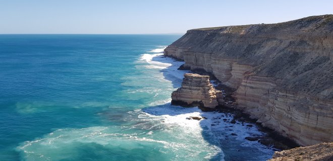
Island Rock
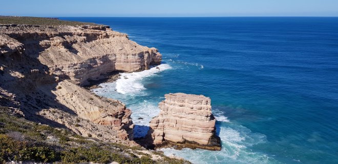
Island rock
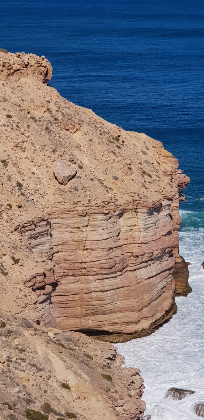
That block looks ready to slip……
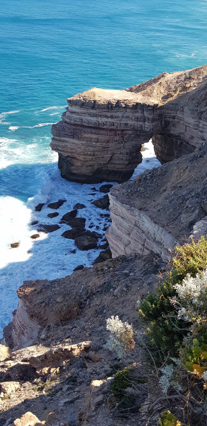
Natural Bridge
Island Rock
Eagle Gorge
Eagle Gorge Beach
Looking across Pot Alley
Pot Alley
By now, the cold wind was easing and the day was hotting up. We headed back to town for a coffee and discovered a coffee van at Jakes Beach, set up complete with comfy camp chairs so we could take in the morning sun and enjoy the view with our coffee.
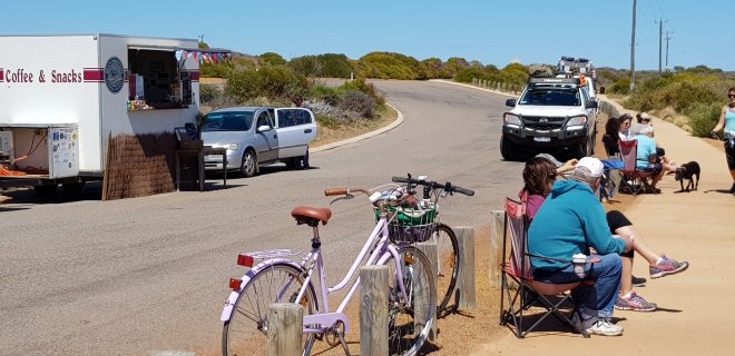
Coffee Kalbarri Style
After a relaxing break, we headed back to Rainbow Valley and enjoyed a walk down to the beach at Mushroom rock and back through the valley of multi coloured rock formations. It was hot now and the walk was hard work, especially climbing back to the car park from the beach. We were ready for lunch when we returned so headed into town for a picnic lunch in the park by the river, very peaceful and relaxing. After lunch, our final destination was Red Bluff and a short walk to the lookout where we enjoyed fantastic views over the surf beach and up to the Murchison River mouth. Again we enjoyed a fantastic day exploring this magnificent park, and especially enjoyed being close to the ocean again.
Rainbow Valley
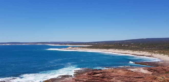
We were going to head off the next day to Murchison Station, but decided to stay another night in the CP in town. It was going to be a hot day and we wanted to explore the river and the township, so being close to town was more suitable. Also, the Station camp sites were busy and pretty dry and dusty so it made the decision to stay in town easy. We enjoyed a fabulous day exploring, paddling in the river and visiting the new lookout just out of town where we enjoyed expansive views over the town and coast. A highlight was visiting the Zuytdorp Memorial Lookout near town where we had spectacular views across the rivermouth to the Zuytdorp Cliffs, north of Kalbarri. The cliffs extend for 150km north from the rivermouth and reach a maximum height of 250m, amongst the tallest sea cliffs in Australia. These cliffs are named after a Dutch East India Company ship that was wrecked on the cliffs in 1712 whilst on a journey to Batavia. The ships passengers were never heard from again, although it is suspected some of them made it to shore and may have even joined up with local aboriginal communities. The wreck was first sighted in 1927, but it wasn’t until 1954 that it was definitively identified as the Zuytdorp. We also enjoyed a relaxing walk along the rive in town.
View from Red Bluff, Zuytdorp Cliffs in the background
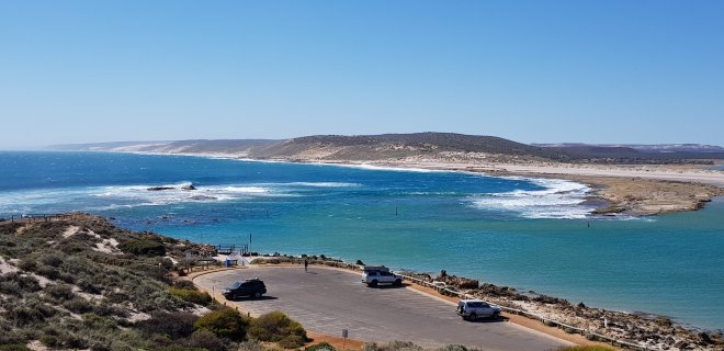
Mouth of the Murchison River
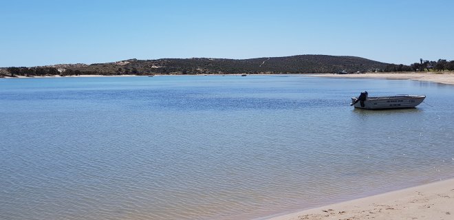
Peaceful Murchison River
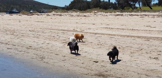
Molly enjoing her walk along the river where she met some little playmates
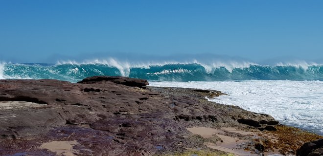
It was a very hot day so we also went down to Blue Holes, a popular local beach with beautiful sea pools amongst the inshore limestone reef, protected from the waves by the main reef, for a swim. It was very refreshing! We also went to Jakes Point, one of WA’s most famous surf breaks. Here you can walk out on the rock shelf and watch the surfers just metres away, surfing past you as they avoid the rocks. We were lucky enough to also see some dolphins surfing with the board riders on the same waves, jumping for joy as their ride finished!
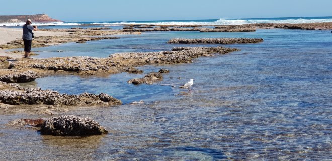
Blue Holes
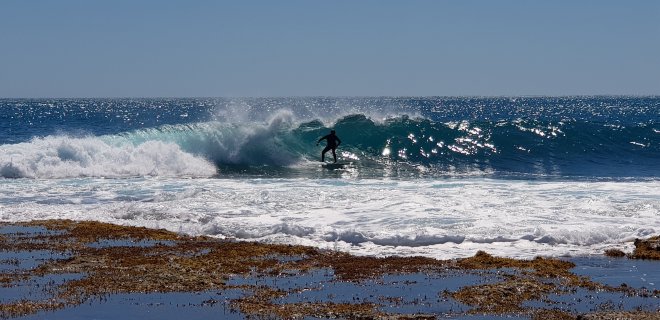
Surfing at Jakes Point
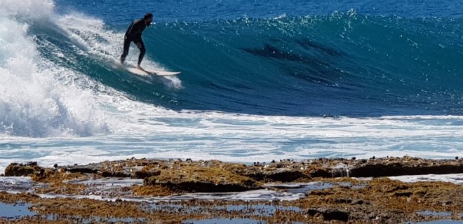
Dolphins enjoying a surf
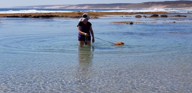
Molly and Deb cooling off at Blue Holes
So, after 3 action packed days, it was time to move on. What a fantastic National Park, one of our favourites. And all centred around a really lovely little village located right on the banks of the Murchison River. It would be crazy to be here in school holidays, but practically any other time of the year it would be perfect. So many things to see and do, or just to sit and relax by the water…….perfect!