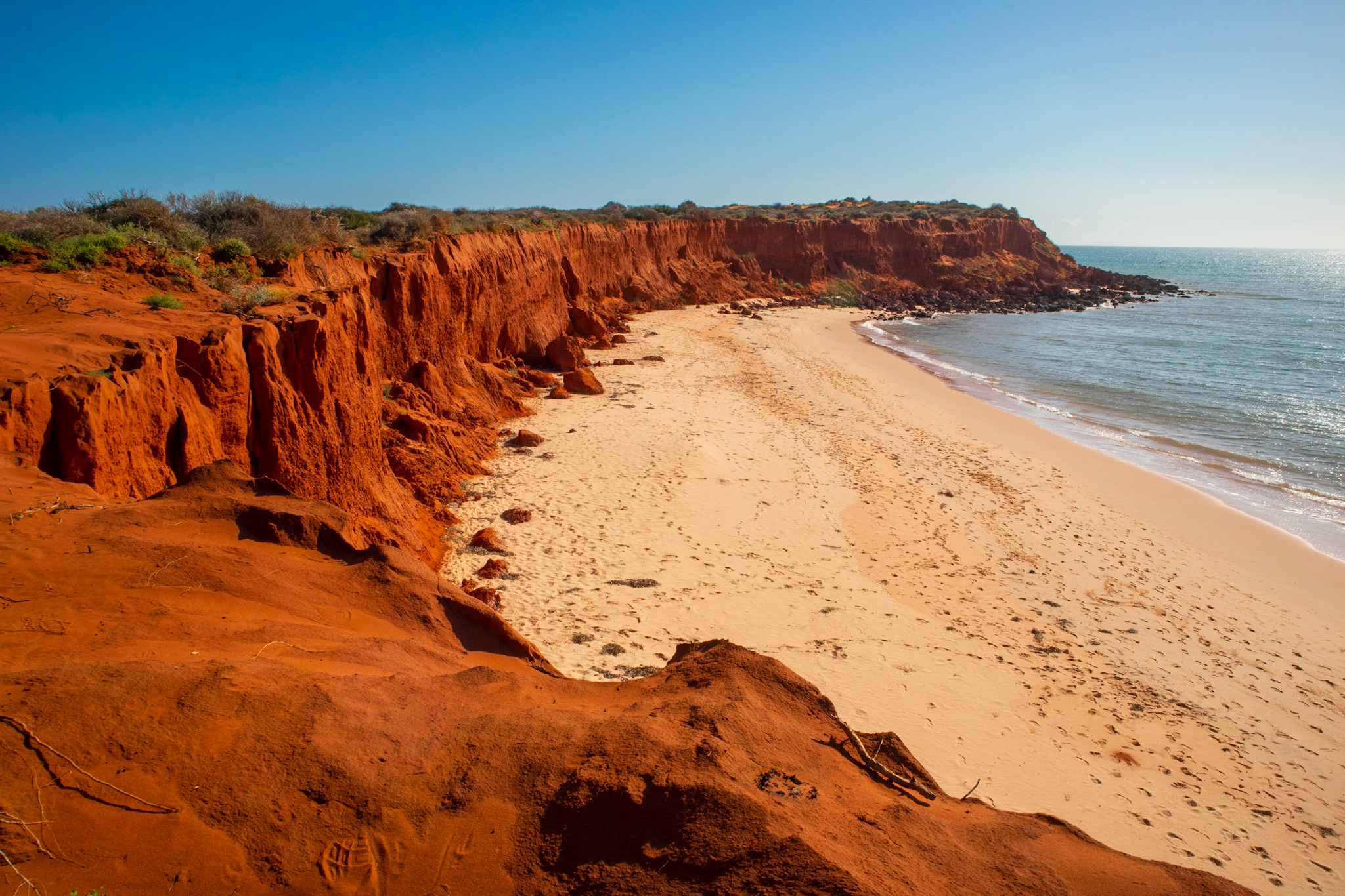
We have just returned from a two week break in Shark Bay. We have always wanted to divert from the main highway to check it out, but to date a visit has eluded us. We always seemed to have other priorities as we drove past the turn off. But as we are in Geraldton for 12 months and Denham is just 5 hours drive away, we decided to head there for a holiday. Shark Bay is a World Heritage Area that lies on the west coast between Geraldton and Carnarvon. Its that place that sticks out of the very westernmost part of the west coast, a couple of long peninsulars and islands including Steep Point, the westernmost part of the Australian mainland. As we discovered, its a remarkable area and I will share some of its treasures with you over the next few blogs. But first, some history……
Aboriginal people first inhabited Shark Bay some 30,000 years ago and moved to and from the area in response to changing sea levels and availability of fresh water and food. Shark Bay is the traditional country of three Aboriginal language groups: Malgana, Nhanda and Yingkarta. The Malgana name for Shark Bay is Gutharraguda, which means ‘two bays’ or ‘two waters’. There are about 130 registered Aboriginal heritage sites in the Shark Bay area including quarries, rock shelters, burial sites and large scatters of discarded shells, bone and other food-related artefacts known as middens. It wasnt until the late 1770’s that Europeans first met and interacted with the indigenous inhabitants.

The first Europeans to sight the land around Shark Bay would have been Dutch and Portuguese sailors navigating their way to the East Indies as part of the spice trade in the late 1500’s. There were no recorded landing until 1616, when Dirk Hartog landed on what is now known as Dirk Hartog Island, just north of Steep Point. Dirk was the guy who left the famous pewter plate nailed to timber jammed into a cleft in the rock at Inscription Point on the western side of the island, declaring some details of his visit. In the ensuing years, there were records of sailors landing on the Abrolhos Islands to the south, including the infamous Batavia wreck in 1629, but no more landings in Shark Bay until De Vlamingh in 1697. De Vlamingh had been ordered to scour the coast for old shipwrecks and possible survivors and had been making his way northwards after stopping at the Swan River and Rottnest Island. He landed at the same location as Hartog and found his pewter plate. He decided to retrieve it to take back to Amsterdam, replacing it with his own pewter plate, incribed with Hartog’s original message as well as his own. Hartog’s plate is still on display in the Rijkmuseum in Amsterdam.

The next notable visitor to the region was William Dampier an English navigator, explorer and “privateer”. Thats code for Pirate, except his expeditions were often sponsored by the British government! In 1697 Dampier was commissioned to explore the coasts of New Holland aboard HMS Roebuck. He arrived at Dirk Hartog Island in August 1699 and anchored at a place now called Dampier’s Landing but did not see the pewter plate left by Willem de Vlamingh. To be fair to Dampier, he was a skilled naturalist and made many observations of local wildlife and flora. His collection of Australian plants is still preserved at Oxford University. He named the area Shark Bay because of the large number of sharks he saw in the waters there.
François de Saint-Alouarn was a French navigator who arrived at Turtle Bay on Dirk Hartog Island in 1772. There he claimed possession of the western half of New Holland for King Louis XVI. This was two years after Captain James Cook landed at Botany Bay. He continued sailing north to Indonesia. The French never followed up on this claim on the continent.
The next significant visitor was Nicolas Baudin. In 1801 Baudin’s corvettes, Le Géographe and Le Naturaliste, spent 70 days in Shark Bay exploring and mapping the region. Emmanual Hamelin, the commander of Le Naturaliste, discovered the plate left by Willem de Vlamingh in 1697, but he refused to souvenir it, instead putting his own plate next to it. Hamelin’s plate has never been found. Francois Peron was part of this expedition also, initially as Trainee Zoologist. He became Chief Zoologist when many of Baudin’s crew deserted the ship in Mauritius. (apparantly Baudin wasn’t the easiest man to get along with!) Baudin then headed south and mapped the entire South West and Southern Coast, right around to Kangaroo Island. That explains the many French names that can be found on this coast, including Geographe Bay, Cape Naturaliste, Hamelin Bay, Esperance, Cape Le Grand and Recherche Archipeligo. He even met up with the great Mathew Flinders, who was mapping the coaastline from the east, near Victor Harbour, at a bay now called Encounter Bay. There are a number of monuments to Baudin along the West Australian coastline including busts at Shark Bay, Busselton and Albany. He was a significant explorer, cartogropher and naturalist and it’s well worth reading more about his adventures in the Wikipedia entry. https://en.wikipedia.org/wiki/Nicolas_Baudin

Louis Claude de Saulces de Freycinet was also part of Baudin’s expedition. He returned to Shark Bay on his own expedition, with his stowaway wife, in 1818. He was unhappy with Hamelin’s decision to leave the Vlamingh Plate on Dirk Hartog Island 17 years earlier, so he went to the island and nicked it, eventually taking it to Paris after being shipwrecked on the Falklands Islands on his return journey. 129 years later, after Australia’s couragous defence of France in World War II, the plate was returned to Australia in recognition of its war efforts. It now resides in the WA Maritim Museum in Fremantle.
Apart from visitations from some explorers, including King, Row, Grey and Gregory, there was no significant development in the Shark Bay region for the nex 60 years. The first settlement of the region was by the German Francis Louis Von Bibra who established a small sheep grazing business on Dirk Hartog Island in the late 1870’s. He also commenced mining the guano deposits on the offshore islands. Pearling began a little earlier in temporary camps near Useless Loop, manned by “Malay” divers working for Mr Francis Cadell. A large pearl shell industry soon sprang up in the temporary camps and there was considerable competition between European and Chinese Pearlers. The areas dredged for pearl included Monkey Mia, Useless Loop, Herald Bight and Cape Leseur. Eventually the industry migrated to a base in Freshwater Camp on the Peron Peninsular as there was reliable water located there. Chinese domination of the industry was prevented by government regulations and Freshwater Camp was renamed the township of Denham in 1898. The township was named after Captain Denham, who visited the bay in 1857 and carved an inscription into the rocks at Eagle Bluff. The pearling industry started to decline in the 1890’s, but continued into the 1920’s until plastic buttons replaced pearl shell.
The pastoral development of the bay continued after von Bibra’s early settlement on Dirk Hartog Island. Most of the land surrounding the waters of Shark Bay were used for pastoral leases, predominantly sheep grazing. Many sheep stations sprang up over the years, including Tamala, Hamelin, Nanga and Yaringa. It was a difficult task rasing sheep on these stations and with poor rainfall and even poorer transport infrastructure. Today most of these stations have disappeared, some of the remaining ones surviving as tourist destinations only today. The fishing industry was also significant in the history of the area. A fish cannery was established at Monkey Mia in 1904 employing 100 people. A freezer works at Denham was built and fish exported to Melbourne in the 1920’s. Large scale fishing started in the 1950’s and a permanant fleet was operating out of Denham. Prawning was also established in the 1950’s. In 1967, the fish and prawn processing factory in Denham was closed and transferred to Canarvon, where there was better access to the national highway. Fishing still continues today, but most of the catch is processed and frozen on the boats. The majoy employer in the region now, apart from tourism, is the Salt works at Useless Loop. This large project uses sun power to evaporate water from the highly concentrated waters of the bay. 37 crystalliser ponds produce 1.5 million tonnes of salt per year that is expeorted to Japan for industrial use.
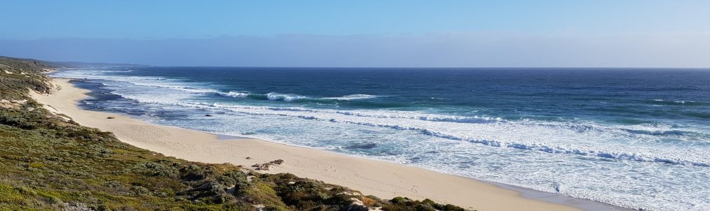
The region is now home to three significant National Parks, Edel Land, Dirk Hartog Island and Francios Peron, which have become very popular locations for travellers seeking remote camping in beautiful coastal wilderness regions. Many people make the long trek through Edel Land to tick off reaching Steep Point, the most westerly point on the Australian mainland. Another popular destination is Monkey Mia, famous for its dolphins that come into the shore nearly every day to interact with humans. They have been the subject of the Shark Bay Dolphin Project for nearly 40 years, the longest dolphin study in the world. In 1991, the Shark Bay region was proclaimed a World Heritage Site, satisfying all four of the natural Outstanding Universal Value criteria. But more about that in coming blogs.